 ExSpade
A Realistic Strip Walk You Can Shorten at Any Point
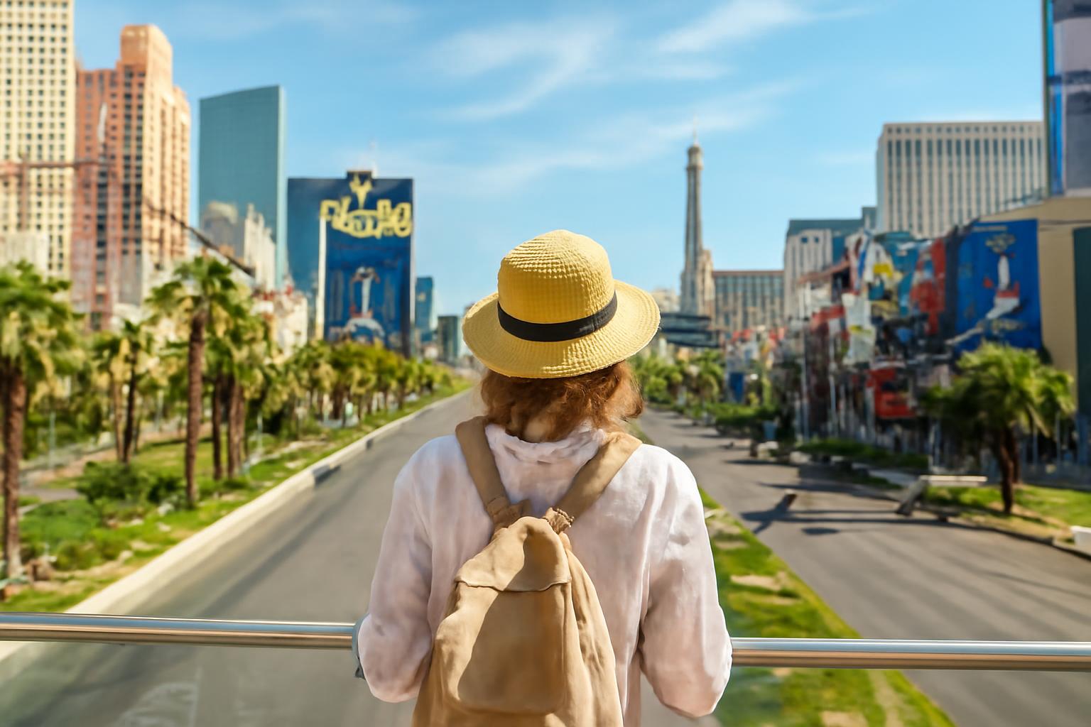
Planning to walk the Vegas Strip: routes, distances and practical tips
Status: This is a general planning framework, not a turn-by-turn access guide. Last evidence review: July 30, 2026. Construction, transportation service, property access and pedestrian routes can change, so verify them before departure.
Planning to walk the Vegas Strip is less about tracing a straight line down Las Vegas Boulevard than deciding how much sightseeing you can comfortably absorb. The street mileage looks manageable, but the practical route includes pedestrian bridges, indirect crossings, enormous resort interiors, shopping corridors, escalators, crowds and frequent reasons to stop.
The most workable strategy is modular: walk in one direction, choose only a few priority properties and identify several places where you can switch to the Monorail, bus, taxi or rideshare. A successful Strip walk is not necessarily one that reaches the farthest endpoint. It is one that leaves enough time and energy for the places you actually wanted to see.
Start With a Reality Check: The Strip Is Longer Than It Looks
There is no single universally useful answer to “How long is the Las Vegas Strip?” Different guides use different boundaries. Some measure a central sightseeing corridor, while others extend the route from Mandalay Bay to the STRAT or use Wynn, Palazzo, SAHARA or another northern property as the endpoint.
For broad planning, Lonely Planet describes the core corridor from Mandalay Bay to the STRAT as approximately 4.3 miles one way. It also lists a shorter Mandalay Bay-to-Wynn itinerary at approximately 2.9 miles and about one hour without stops. Those figures are movement benchmarks, not estimates for a complete sightseeing day (Lonely Planet’s Strip walking route).
A selected central route can be shorter yet take longer because of its planned stops. GPSmyCity, for example, lists a 2.1-mile self-guided route with a stated duration of two hours. The page does not establish that every visitor can meaningfully tour all the listed resorts and attractions in that time (GPSmyCity’s Las Vegas Boulevard walking tour).
Published walking times should not be interpreted as including a leisurely meal, casino play, shopping, photography or substantial resort exploration unless a guide explicitly says so. Even a brief interior visit can become a sizable detour when you need to find an entrance, cross a casino floor, follow signs through a shopping area and locate the correct exit.
The physical route is also less direct than the boulevard suggests. A property that appears to be immediately across the road may require a designated crosswalk or pedestrian bridge. Reaching that bridge can involve an escalator, elevator, ramp, indoor corridor or approach that initially carries you away from your destination.
The distinction that matters most is passing a resort versus exploring it:
- Passing may mean walking along the frontage or viewing an exterior landmark.
- Entering briefly may mean crossing a casino floor or using an indoor connection.
- Exploring may include shops, architecture, a restaurant, an attraction or a large interior loop.
Those are different schedule commitments. Entering several major resorts can affect your day more than the distance shown on a street map.
Do not treat a four-mile Strip route as an ordinary, uninterrupted four-mile sidewalk walk. Meaningful sightseeing involves changes of pace, navigation decisions, indoor mileage and stops. Plan around those realities rather than assuming you can maintain an exercise-walk pace from beginning to end.
Choose a Route Scope Before Choosing Every Stop
Start by deciding how much of the corridor you want to cover. Only then should you choose individual restaurants, interiors, shops or attractions. This prevents a common planning mistake: assembling a long list of stops before accounting for the time and energy required by the route itself.
Whenever practical, begin near your hotel. If you walk away from it, decide how you will return before leaving. A one-way route with a planned ride back is generally easier to manage than an improvised out-and-back walk.
If you have about two hours
Keep the walk within a compact central cluster. Paris, Bellagio, Caesars Palace and nearby crossings toward the LINQ area can serve as practical anchors; they are examples, not an objective ranking of the Strip’s best properties.
Choose only one resort for deeper interior exploration. At the others, limit yourself to an exterior view, frontage walk or short interior look. Touring every casino floor, shopping area and attraction is not a realistic two-hour highlights plan.
One possible priority structure is:
- Priority: Bellagio and one other property that most interests you
- Optional: Paris frontage or Caesars Palace
- Skip if tired or behind schedule: Continuing toward LINQ Promenade
Keep the final stop adjustable. If a meal, crowd or interior detour consumes more time than expected, finish where you are instead of rushing through the remaining landmarks.
If you have half a day
Begin around New York-New York or MGM Grand, then proceed north through the central resort corridor. Paris and Bellagio provide clear visual anchors before you continue toward Caesars Palace.
Choose the endpoint according to your remaining time and energy:
- Finish near Caesars Palace for the shorter version.
- Continue toward Flamingo and LINQ Promenade if conditions remain comfortable.
- Extend to the Venetian area only if earlier interiors have not absorbed substantial time.
This is an adjustable framework, not a guaranteed half-day schedule. A long lunch, attraction, shopping visit or casino stop can materially change the endpoint.
If you have a full day
Use a one-way south-to-north route. Start at Mandalay Bay for the longer version or New York-New York for a shorter version, then work toward the Venetian or Wynn.
Build the day around breaks rather than treating them as delays. Include time for a meal, water, air conditioning and at least one period when you sit rather than stand. Select two or three resorts for genuine exploration and treat the rest as exterior or pass-through stops.
A full day still should not mean entering every property. If you start at Mandalay Bay and spend significant time in the southern resorts, the Venetian may become a sensible endpoint even if Wynn was the original goal.
Plan the return ride before starting. Walking south again after a full northbound sightseeing day adds distance without providing many new views.
If you have two days
Dividing the corridor is generally more realistic for visitors who want to explore multiple resort interiors.
One possible split is:
- Day one — south and central: Mandalay Bay or New York-New York through Paris, Bellagio and Caesars Palace
- Day two — central and north-central: Flamingo and LINQ Promenade through the Venetian and Palazzo area, with Wynn as an optional extension
Adjust the split around your hotel. A central hotel makes it easier to walk south on one day and north on another without repeating the entire corridor.
For either day, label every planned stop:
- Priority: You would be disappointed to miss it.
- Optional: Visit if time and energy allow.
- Skip if tired: Remove it without undermining the walk’s main purpose.
Bellagio, Caesars Palace, LINQ Promenade and the Venetian can form one practical set of priority candidates. Your list might instead emphasize architecture, dining, shopping, photography or a particular attraction. The useful part of the system is limiting the list before you start.
A Modular South-to-North Strip Walking Plan
This route has three modules. You can begin at the start of any module, stop at any listed turnaround area or combine the modules for a longer outing. None is mandatory, and the directions below are not a substitute for current signs or a live map.
South module: Mandalay Bay to New York-New York
For the longest version, begin at Mandalay Bay and move north using the indoor connection through Luxor and Excalibur. From the Excalibur area, follow the designated pedestrian route toward New York-New York.
The indoor southern connection can reduce some outdoor exposure, but it does not create a continuous climate-controlled route for the remainder of the Strip.
Starting at New York-New York is the better choice when you want to conserve time and energy for the central landmarks. It removes the southernmost module without sacrificing access to the denser central corridor.
New York-New York is also a useful decision point. Pause, reassess the weather and crowds, and decide whether your objective is a short central walk or a longer northbound outing.
Central module: New York-New York to Flamingo
Continue north from New York-New York toward the central resort cluster. The practical path may use sidewalks, bridges, escalators, crosswalks, resort approaches and indoor areas rather than following a perfectly straight line.
Paris and Bellagio are prominent visual landmarks in this section. Consider treating one as an exterior stop and reserving meaningful interior time for the other.
From Bellagio, continue toward Caesars Palace. Reaching Caesars and exploring its casino, shops, restaurants and interior corridors are not equivalent tasks. If Caesars is a priority, budget for it as a destination rather than a quick point on the map.
Flamingo provides a practical endpoint for a central-only route. It also places you near the next resort cluster and a Monorail station, although reaching the station entrance can require additional walking.
North-central module: Flamingo to Wynn
From Flamingo, continue toward LINQ Promenade, then the Venetian and Palazzo area. Wynn is a possible endpoint for the longer version.
This module can absorb considerable time because it offers many opportunities to leave the direct route. If the Venetian is a priority, consider ending there rather than treating it as one more quick stop on the way to Wynn.
The route summary below is a planning framework. It does not confirm the current availability of a particular passage, elevator, bus stop, taxi line or rideshare pickup point.
| Module | Principal landmarks | Likely indoor portions | Logical turnaround point | Transit fallback to investigate |
|---|---|---|---|---|
| South | Mandalay Bay, Luxor, Excalibur, New York-New York | Connections among the southern resorts | New York-New York or MGM Grand area | MGM Grand Monorail; designated taxi or rideshare pickup; current bus service |
| Central | New York-New York, Paris, Bellagio, Caesars Palace, Flamingo | Casino floors, shopping corridors and resort approaches | Bellagio, Caesars Palace or Flamingo | MGM Grand, Horseshoe/Paris or Flamingo/Caesars Palace Monorail stations; taxi, rideshare or current bus service |
| North-central | Flamingo, LINQ Promenade, Venetian and Palazzo area, optional Wynn | Resort corridors and shopping areas | LINQ, Venetian area or Wynn | Flamingo/Caesars Palace or Harrah’s/The LINQ Monorail stations; taxi, rideshare or current bus service |
The table deliberately avoids exact stop-inclusive times. Your pace will depend on where you enter properties, how long you remain inside, whether crossings are crowded and how many unplanned stops you make.
Construction, redevelopment, property names, sidewalks and pedestrian access can change. Older maps may use former properties or attractions as navigation anchors. Do not rely on the former Tropicana or Mirage as currently operating attractions.
Shortly before departure, check the relevant resort websites, transportation operators and a current map. On the day of the walk, check again for temporary closures or changed access. This itinerary has not been presented as a physically verified, turn-by-turn route.
Daylight, Neon or Extreme Heat: Pick the Right Walking Window
There is no universally best time to walk the Strip. Day and night offer different experiences, and the weather may matter more than the atmosphere.
Walking during the day
Daytime can have a lighter, more family-oriented atmosphere, particularly before evening nightlife crowds build.
The trade-off is heat. Warmer-month temperatures often exceed 100°F, which can make a long exposed walk impractical for some visitors (daytime and nighttime Strip considerations).
For a daytime walk:
- Carry water rather than assuming you will immediately find a refill point.
- Apply sunscreen and bring it for reapplication.
- Wear breathable clothing appropriate to the forecast.
- Use indoor breaks before you become exhausted.
- Shorten the route when heat, health, age or walking tolerance makes the original plan unrealistic.
- Avoid tightly timed reservations that leave no room to cool down.
Indoor resort passages can provide useful breaks, but they do not form an uninterrupted air-conditioned route along the Strip. Exposed sidewalks, bridge approaches and outdoor crossings remain part of the walk.
Walking at night
At night, illuminated resort exteriors become part of the experience, and conditions may be cooler than during the day.
Remain on populated, well-lit tourist routes, pay attention to your surroundings and keep a transportation exit available. General visitor-safety guidance also recommends returning toward crowded tourist areas rather than following quiet side streets that appear to offer shortcuts (Las Vegas travel precautions).
Nighttime is neither guaranteed safe nor categorically unsafe. Conditions vary with location, crowd levels, events and time. Situational awareness and a ready exit plan are more useful than a blanket label.
When the weather should change the plan
There is no universal temperature or heat-index cutoff suitable for every traveler.
When the forecast looks challenging, shorten the route before leaving. Start at New York-New York rather than Mandalay Bay, limit the walk to the central module or replace an exposed segment with transit.
If heat, pain, dizziness or fatigue makes continuing feel unwise, stop in a suitable place and cool down rather than trying to reach an arbitrary endpoint. General Las Vegas visitor guidance likewise warns against underestimating hot-weather exertion, long walking distances and unsuitable footwear (hot-weather and walking precautions).
Crossings, Resort Interiors and Accessibility Caveats
Use designated crosswalks and pedestrian bridges. Do not improvise a direct crossing of Las Vegas Boulevard merely because the desired property looks close.
A bridge can separate pedestrians from boulevard traffic, but it may also lengthen the route. You may need to approach from the correct corner, travel up by escalator, elevator, stairs or ramp, cross above the road and then navigate a resort entrance on the opposite side.
Keep your attention on traffic signals, vehicles, other pedestrians and the walking surface. Stop in a suitable location before checking your phone or taking a photograph rather than doing either while crossing.
Inside and outside resorts, watch for wet floors, uneven pavement, crowded corridors, luggage and sudden changes in pedestrian direction. General pedestrian guidance recommends designated crossings, attention around traffic and avoiding phone use or photography while crossing (Strip pedestrian-safety overview).
Do not assume the route is fully accessible because a bridge or elevator appears on a map. The available evidence does not verify current elevator availability, escalator status, gradients, step-free alternatives, door arrangements or the length of accessible approaches at each crossing.
Wheelchair users, visitors with strollers, older travelers and anyone with limited mobility should check each planned segment with the relevant properties and transportation operators before departure. Ask about:
- Current step-free access to the intended crossing
- Elevator location and operating status
- Temporary construction barriers
- Long ramps or indirect resort approaches
- Accessible access to the intended transit station
- An alternative pickup point if the walking route becomes impractical
A bridge with an elevator is not necessarily a short route, and an accessible entrance may be far from the most obvious frontage. Build flexibility into the itinerary rather than assuming every traveler can use the same path.
Editorial note: Temporary construction, maintenance, crowd controls, private events and property redevelopment can override any static map. Follow current signs and staff directions, even when they differ from a saved route.
What to Wear, Carry and Decide Before Leaving the Hotel
Wear supportive, broken-in walking shoes. New shoes, high heels or footwear selected only for nightlife appearance can become uncomfortable when the route expands through bridges, casino floors and shopping corridors.
Dress for both the forecast and indoor air conditioning. Breathable hot-weather clothing is useful in warm conditions, while a light layer may make longer indoor breaks more comfortable.
Carry only what you can manage comfortably:
- Water
- Sunscreen
- A charged phone
- Payment method and identification
- A compact light layer when appropriate
- Personal items you normally need for a longer outing
Do not depend on a particular water-refill point, restroom, seat or cooling area unless you have verified it.
Eat before a long route or plan a meal during it. Pausing to eat and reassess the next module is more practical than walking continuously to protect an unrealistic schedule.
Keep the pace flexible. A tightly packed series of restaurant bookings, show times and attraction reservations can turn small navigation delays into a stressful day. If you have a fixed appointment, plan to finish the walking portion near that location well in advance.
In crowds, keep control of wallets, phones and bags, and do not leave drinks or possessions unattended. These are precautionary measures rather than a guarantee against theft or other incidents.
Before leaving the hotel, review this checklist:
- Route modules: Which section or sections are you attempting?
- Priority stops: Which two or three places matter most?
- Optional stops: Which interiors can be dropped?
- Turnaround point: Where will you stop even if you still have some energy?
- Transportation fallback: Which station or designated pickup location will you investigate?
- Weather check: Should the route be shortened or moved to a cooler period?
- Attraction check: Are your intended destinations currently operating?
- Pedestrian-access check: Are construction or closures affecting the route?
- Return plan: Can you get back without retracing the entire walk?
If heat, pain, dizziness or fatigue makes the next module feel unwise, shorten the route. The plan should make stopping easier, not pressure you into finishing.
Build in a Ride Back: Monorail, Bus, Taxi and Rideshare Options
The simplest structure is a one-way walk followed by a ride back. Do not assume that because you can comfortably walk north at the beginning of the day, you will want to repeat the same distance south after sightseeing.
Las Vegas Monorail
The Las Vegas Monorail operates on a 3.9-mile elevated route between MGM Grand and SAHARA. The operator lists seven stations and reports an end-to-end journey of about 15 minutes, excluding boarding and exiting, with trains approximately every four to eight minutes (official Las Vegas Monorail route map):
- MGM Grand
- Horseshoe/Paris
- Flamingo/Caesars Palace
- Harrah’s/The LINQ
- Boingo Station at the Las Vegas Convention Center
- Westgate
- SAHARA
Verify current hours and service conditions before relying on the Monorail.
The line runs east of Las Vegas Boulevard and does not stop at every resort. Reaching a station can require additional walking through or around a property, so “near a station” should not be interpreted as “at the platform.”
For this modular walk, the most directly useful stations are often MGM Grand, Horseshoe/Paris, Flamingo/Caesars Palace and Harrah’s/The LINQ. The northern stations can help when broader plans take you toward the convention center, Westgate or SAHARA.
The Monorail does not directly serve downtown Las Vegas or Fremont Street. Reaching those areas requires another transportation option or transfer.
Deuce bus
Visit Las Vegas describes the Deuce as stopping near most Strip resorts. That can make it useful when your endpoint is inconvenient to the Monorail, but stops, fares, schedules and service patterns should be confirmed with the current operator.
The same transportation overview explains the available mix of Monorail, bus, taxi and rideshare options and notes that taxis generally collect passengers at physical addresses such as hotel taxi lines rather than accepting street hails (Visit Las Vegas transportation guide).
Taxis
Use a hotel taxi line or another designated pickup location. Do not build the return plan around hailing a cab from the roadside.
If you expect to finish at a large property, locate its taxi area before you become tired.
Rideshare
Rideshare can be useful when reaching the nearest transit station would require an unwanted detour or when you need a direct return to your hotel. Check current instructions in the app or with property staff.
Transit, taxis and rideshare are sensible responses to:
- Excessive heat
- Unexpected fatigue or pain
- A long interior detour
- Time pressure
- Discomfort after dark
- A change in weather
- Construction that makes the route less direct
- Simply having seen enough for one day
Do not treat walking from Harry Reid International Airport as the opening module of the sightseeing route. Proximity on a map does not make the airport approach a normal pedestrian extension of the Strip. Fremont Street is likewise a separate destination rather than a practical continuation of this walk.
Keep Casino Stops Optional and the Walking Plan in Control
Casino floors, restaurants, shops and attractions can turn a short route into a much longer outing. Decide in advance which properties merit an interior stop and which you will simply pass.
Walking priorities and gambling decisions should remain separate. You can enter a resort to see its architecture, eat, shop, cool down or reach another exit without placing a bet.
ExSpade advises deciding limits before gambling and treating play as paid entertainment rather than a way to finance a trip.
No betting system can remove the negative expected value built into casino games. A staking pattern may change the sequence of wins and losses, but it does not change the underlying economics of the wager.
Use only money you can afford to lose and set a loss limit before play. If gambling stops being entertainment, ExSpade’s About page directs readers to 1-800-GAMBLER.
Use one decision rule throughout the day: preserve the priority route, skip optional interiors when behind schedule and take the planned transportation exit rather than forcing completion.
Before departure, reduce the plan to three decisions:
- Choose a route module that matches the available time.
- Select only a few priority stops.
- Decide where you will stop walking.
A successful Strip walk is not one that covers every resort. It is one that accounts for indirect crossings, interior mileage, weather, fatigue and a reliable ride back. Check current weather, pedestrian access, attraction status and transportation service on the day of the walk.
Frequently Asked Questions
How long does it take to walk the entire Las Vegas Strip?
It depends on what you define as the Strip and whether you are merely moving or sightseeing. Lonely Planet describes the broader Mandalay Bay-to-STRAT core as approximately 4.3 miles one way, while shorter selected routes use different endpoints.
A brisk movement estimate is not a touring estimate. Bridges, resort approaches, photographs, meals, shopping, casino floors and attractions can turn the outing into a substantial part of a day. If you want to explore several properties, consider splitting the corridor across two days.
What is the best Strip walking route for a first-time visitor?
For many first-time visitors, a central one-way route is more manageable than attempting the entire corridor. Start near New York-New York, continue toward Paris and Bellagio, and then proceed to Caesars Palace, LINQ Promenade or the Venetian according to your time and energy.
Choose two or three priority properties and plan a ride back. Start near Mandalay Bay only if the southern resorts are important to you and you have allowed time for that additional module.
Is it better to walk the Las Vegas Strip during the day or at night?
Daytime may bring a lighter atmosphere and easier navigation, but hot weather can make an extended outdoor route impractical. Night offers illuminated resort exteriors and potentially cooler conditions, along with denser nightlife crowds.
Choose according to the forecast, your interests and your walking tolerance. During either period, use designated pedestrian routes and keep a transit, taxi or rideshare exit available.
Can I use the Monorail if I get tired, and does it reach Fremont Street?
Yes, if your route places you reasonably close to one of the Monorail’s seven stations. The official system runs 3.9 miles between MGM Grand and SAHARA, but its east-of-boulevard alignment means reaching a station may require additional walking.
It does not directly reach Fremont Street or downtown Las Vegas. You will need another transportation option or transfer, and you should verify current service before depending on it.
Can I walk from Harry Reid International Airport to a Strip hotel?
Do not treat the airport-to-hotel journey as a normal sightseeing walk.
Use an established airport transportation option, then begin your Strip walk from your hotel or a clearly defined pedestrian module.